Cindy Nance
Dr. Cindy Nance
Dr. Cindy Nance is currently an Associate Professor in Geography at Mt. San Jacinto College. As a graduate student at Northern Arizona University, Cindy has worked for various archeological firms, and grant funded survey projects. Dr. Nance has also worked for various government agencies such as the Coconino National Forest and museums, the Louisiana Oil Spill Commission to help with efforts after the Exxon Valdez accident, and the Louisiana State University Division of Archaeology which was tasked with identifying known archaeological sites prior to issuing construction permits. Dr. Nance has had an exemplary professional career, along with a distinguished career as an educator, which has influenced the lives, and careers, of countless GIS students and professionals.
Q: When did you first discover GIS? Did you have any mentors, classes, colleagues, or professors that inspired you along the way?
A: As a child, I was inspired by National Geographic maps during weekends at my grandparents off-grid homestead. As a community college archaeology student, I worked on land surveys and historic sites in California’s high desert. At UC Berkeley, I used mylars with overhead projection to visualize land records through time for a site proposed for development. Through the dawn of the computer age, I beta tested various software, hardware and mainframes for document production which relied on programming language (no graphical user interface) and dot matrix printer output.
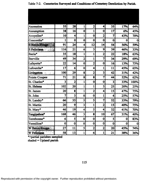
As a graduate student at Northern Arizona University, working for various archeological firms and grant funded survey projects, I enrolled in GIS courses in the geography department, using a variety of software for various tasks, such as Idrisi, before ESRI integrated diverse applications into their software package, circa 2000. At Louisiana State University, I continued my interest in archaeology and mapping with GIS to research cemetery conditions over time, considering proximity, adjacency and connectivity while also working at the state’s Division of Archaeology which was tasked with identifying known archaeological sites prior to issuing construction permits. Previously, I had worked for various agencies, such as the Coconino National Forest and museums to coordinate USGS maps with archaeological site records, and the Louisiana Oil Spill Commission’s federal project to identify land/water conditions in the event of an oil spill, after Exxon Valdez accident.
Without academic mentors to steer me in the right direction, reign in my curiosity, support my research, and provide career guidance, I was unlikely to succeed in academia: James Deetz (UCB), Charles Hoffman and Leland Dexter (NAU), Dewitt Braud and Heather McKillop (LSU), to name a few.
My long-term career goal was to create a spatial relational database of Mayan archaeological sites, coordinating various museum archives sites and artifact records, to identify the extent of trade routes, i.e. shared pottery styles in the southwest, preserve known sites and predict unknown site locations based on terrain features, was not realized. Instead, I found meaning and purpose in teaching GIS at Mt. San Jacinto College, focusing on data acquisition and spatial analysis, and realized my highest achievement in student success in their careers and personal accomplishments.
Q: As an Associate Professor of Geography what does a typical workday look like for you?
A: Preparing lecture materials, grading and presenting information to students to meet curriculum and transfer requirements, and career guidance and mentoring. I have not taught GIS courses for the Certificate or Associates Transfer Degree since 2012. Nevertheless, GIS and map interpretation remain my passion and are integrated in my General Education courses.
Q: What GIS project are you most proud of?
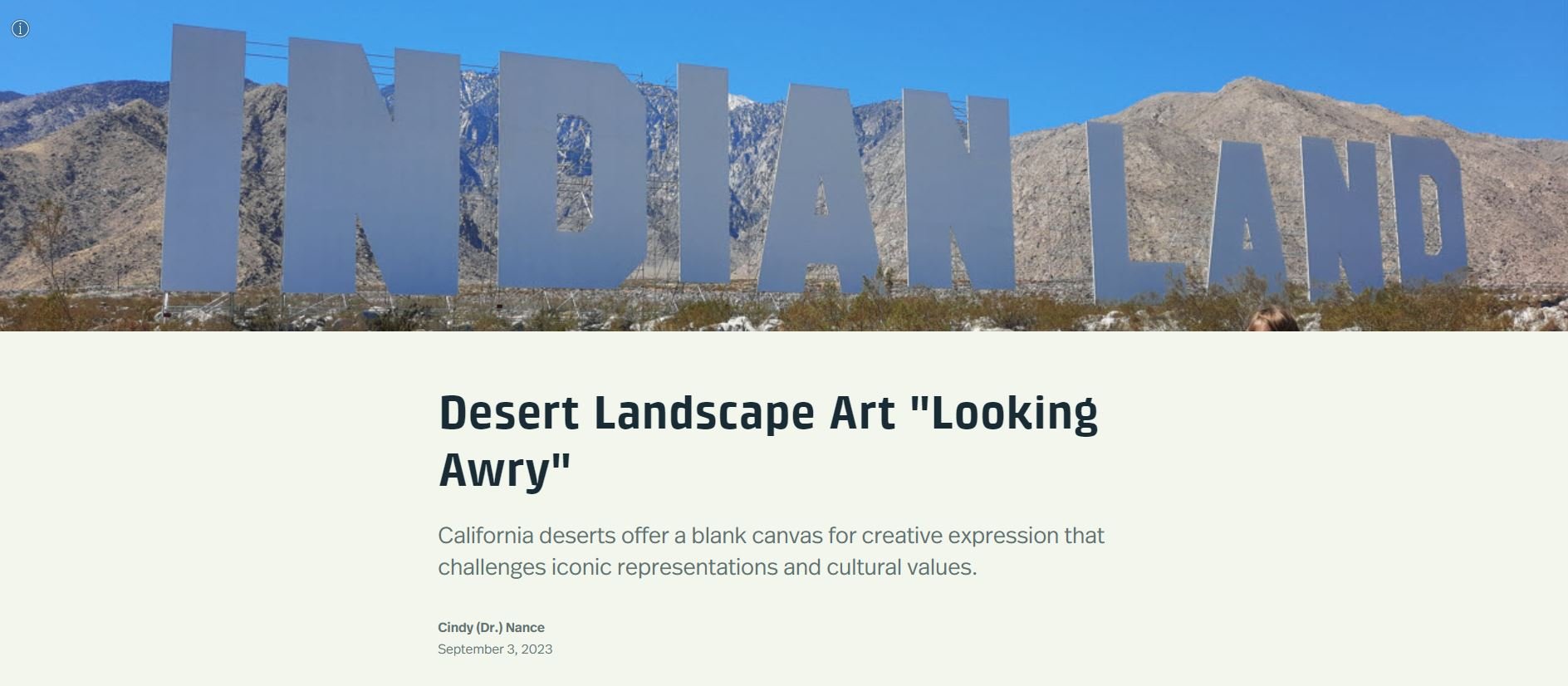
A: My published dissertation on stages of cemetery abandonment and evolving spatial attitudes about death (https://repository.lsu.edu/gradschool_disstheses/7113/). And my recent publication available at CSU Northridge (https://scholarworks.calstate.edu/concern/publications/ws859p94z ) visualized with an ArcGIS Story Map - Desert Landscape Art “Looking Awry” (https://arcg.is/0CGXC40).
Q: What has been most valuable to you in the GIS sector to learn modern technology or advance your career to the next level?
A: As a GIS instructor, software upgrades were required semester-by-semester and thus practical applications that I created were updated. Annually, I attended local, state and international conferences. I frequently attended workshops to update my skills to integrate spatial innovations and disseminate to others. Over three decades, I presented and organized GIS and Geography events, receiving an Excellence in Education award 2011 CGIA/URISSA conference.
As an instructor, I did not apply GIS in the field, mostly worked on a keyboard, including creating, updating and sharing curriculum for transfer with community colleges and universities. I believe that integration of drone technology with GIS applications in archaeology, environmental research, and emergency response will provide more field opportunities for student careers.
As a retiree, I imagine using GIS as a volunteer on NGO projects. Or virtually travel using Google Earth imagery for signs of prehistoric and historic structural remains yet to be excavated. I intend to continue my photo-essays on landscape art. My passion for maps and spatial analysis persists.
Q: What is something you have enjoyed as being part of the IEGIS User Group?
A: Semi-monthly IEGIS and Palm Desert user group meetings, with ESRI representatives introducing new applications, created a network of employment opportunities for myself and later my students. While seeking GIS employment in the government sector, user group attendees and presenters shared professional experiences and recommended contacts. Over two years of employment applications and interviews, I had several job offers, and ultimately, a 25-year career at Mt. San Jacinto College, for which I am grateful.


